An introduction to the temples in the Angkor Archaeological Park, near Siem Reap, Cambodia, for the first-time visitor – practical advice
By Rick’s Café Noir – 10 October 2025 (updated 14 Jan 2026, in bold italics – access to the 3rd level of Angkor Wat, the Bakan)
Many tourists going to Cambodia will visit the temples at Angkor. What they are actually exploring is the Angkor Archaeological Park, designated as a UNESCO World Heritage Site in 1992 – a must-see site for travel photographers and history buffs, and not to be missed.
This guide is written in three parts.
Part 1 is an introduction to the Angkor temples – a historical overview and some clarification.
This Part 2 contains practical advice for visiting the temples – click on the links below in Part 2 to read the contents listed.
Part 3 has some general advice on photography, and some useful resources.
Part 1 – historical overview and clarification:
- The Angkor Archaeological Park
- Temple Timeline
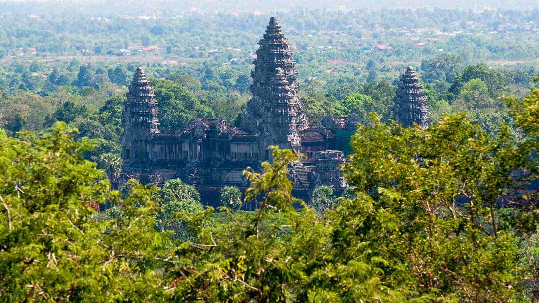
- What is Angkor Wat?
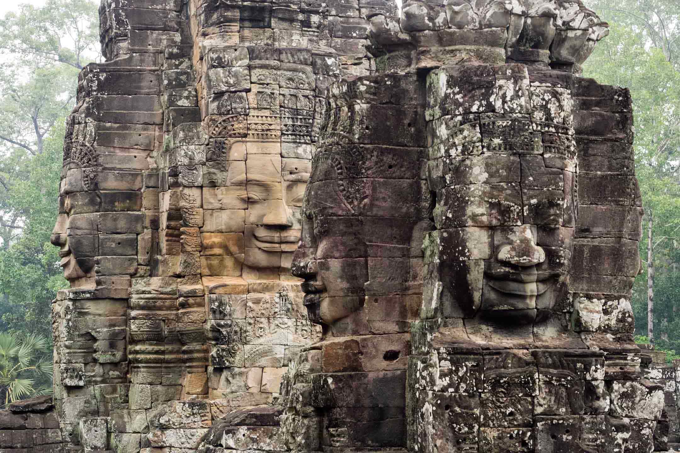
- The Face Towers of Angkor
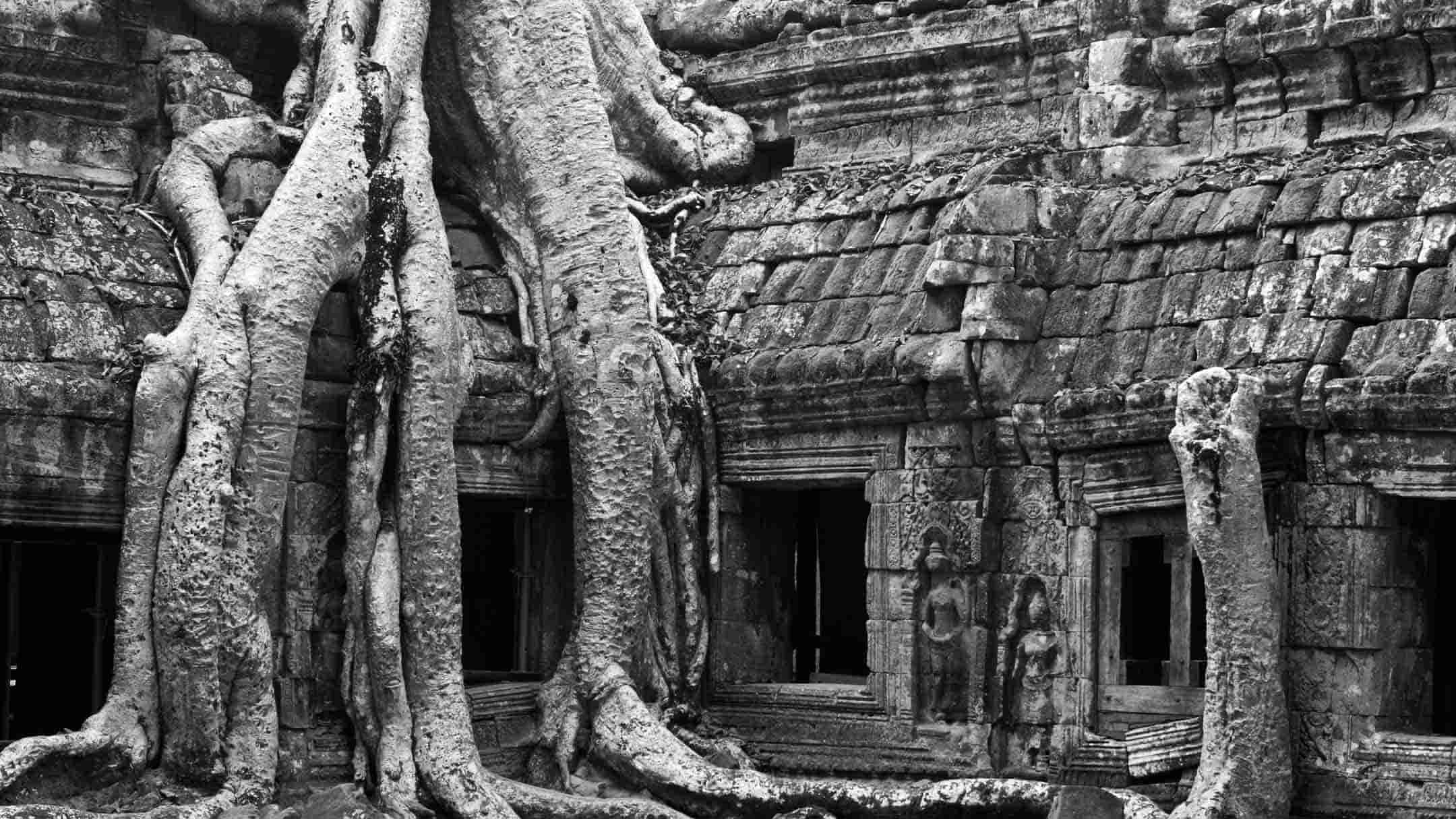
- Tree Roots Growing Over Stone
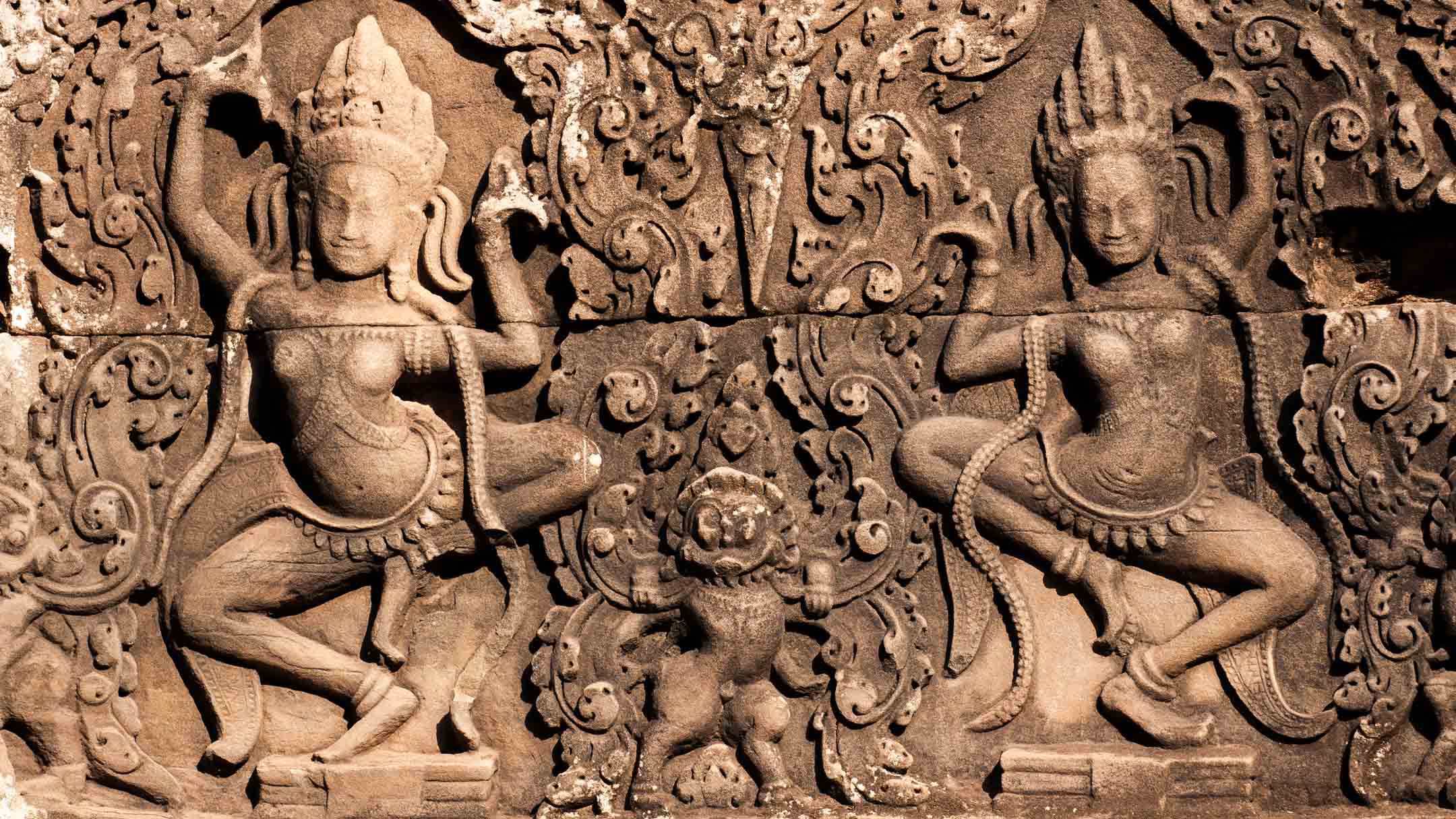
- Apsaras or Devatas
- Other Posts on the Angkor Temples
Part 2 – use the links below to jump to:
- Visiting the Temples
- Small Tour Circuit
- Grand Tour Circuit
- Opening Hours
- Sun Exposure
- Accessibility
- Toilets
- Water and Food
- Landmines
- Ticket Pricing
- Other Posts on the Angkor Temples
- Camera Gear
Part 3 – general advice for photographers, and resources:
- Advice for Photographers
- The Best Temple Guidebook
- Resources
- Last Thoughts
- Other Posts on the Angkor Temples
Visiting the Temples
The Angkor Archaeological Park covers a large area near Siem Reap town – in the NW Cambodian province of Siem Reap – between the Tonle Sap lake to the south and the Phnom Kulen hills to the north-east.
The Angkor Archaeological Park contains over 80 temples and monuments built by the Khmer kings who ruled this vast kingdom north of the Tonle Sap lake – including capital cities, and temples and monasteries to house Hindu and Buddhist divinities. So what is the best way to visit them?
Traditionally, there are two routes you can take around the Park, known as the Small Tour Circuit and the Grand Tour Circuit, although, of course, you do not have to follow these routes – you can make your own route. These routes date back to the early 20th century, when tourists first started visiting the temples.

Tuk-tuk and car drivers usually have set daily rates for these routes. These rates can vary, depending on demand – there are a lot of tuk-tuk drivers and the number of tourists visiting the temples is down since the pre-pandemic peak.
Since the pandemic, tourist numbers have not really picked up much, so this is reflected in the rates – sometimes as low as $15 for the day. Numbers are gradually increasing now, but nowhere near the pre-pandemic peak, so budget around $20 for the day – a little more if you want to include sunrise and sunset (a long day!), the Grand Tour Circuit, or more out-of-the-way temples like Banteay Srei. If the driver knows that you have a 3-day or 7-day pass they may give you a better price, in the hope that you will continue to use them for several days.
In Australia, we rarely tip, but if the driver provides a really good service, tip them – Americans will be used to this. Buy them lunch, and learn about their family. Remember, they may have quoted a low price to get the work, and may be supporting an extended family. It can be a precarious existence.
For that $20 you get a driver for the day. When they drop you off at a temple they will park their tuk-tuk in a parking area amongst a sea of other tuk-tuks, so make sure you can identify your tuk-tuk when you return. Drivers will sometimes sleep while you visit the temple, or play on their phones, or improve their language skills online if they really want to get more more customers. What they will not do is be your guide around the temple.
Official guides have to be licensed by the Cambodian Ministry of Tourism, so if you intend to use one, make sure they are licensed, and be aware that if a guide seems to be really cheap, they may not be licensed.
You will pay extra for a guide, negotiable depending on demand, and additional to the tuk-tuk driver’s fee. Hotels and guesthouse can usually recommend reputable guides. I have never used one. I prefer to do my own research and carry a good guidebook.
The quality of guides vary, particularly regarding language skills and knowledge of the temples. I was once photographing the carvings on the steps near the waterline of the Royal Pond in Angkor Thom when a guide-led group of tourists stopped on the rise above, looking down on the pond. The guide mentioned the dimensions of the pond, the depth of the water, and what it was used for, but said nothing about the carvings on the steps – the main reason for visiting the Royal Pond! I prefer a good guidebook.
Over the years I have had drivers with very poor English, or who objected to changes of itinerary, or were dangerous drivers – one of them veered off the sealed road at the temples and almost overturned the tuk-tuk on the sloping verge! He was actually the cousin of the driver I had arranged to pick me up the day before, who could not make it. So, if you get a good driver, use them for further trips.
If another tourist recommends a good driver, it may be a good idea to use them. The drivers are relying on word-of-mouth recommendations to keep working. Hotels and guesthouses often have a group of tuk-tuk and car drivers they use – usually more expensive, but usually reliable. Sometimes they are extended-family members, so they will be accommodating, and not want to let down the owner of manager of the hotel or guesthouse.
The riskiest, and cheapest, option is to pick a random driver off the street, of which there are many, which is what I usually do!
Talk to them, assess their language skills, if that is important to you – you can always point to temples on an Angkor map, which will sometimes have Khmer script as well as English, or point to your watch or phone to arrange times. Over the years, and many trips to the temples, I have found older drivers to be more reliable, and safer, than younger drivers. Not always the case, I know, but something to consider.
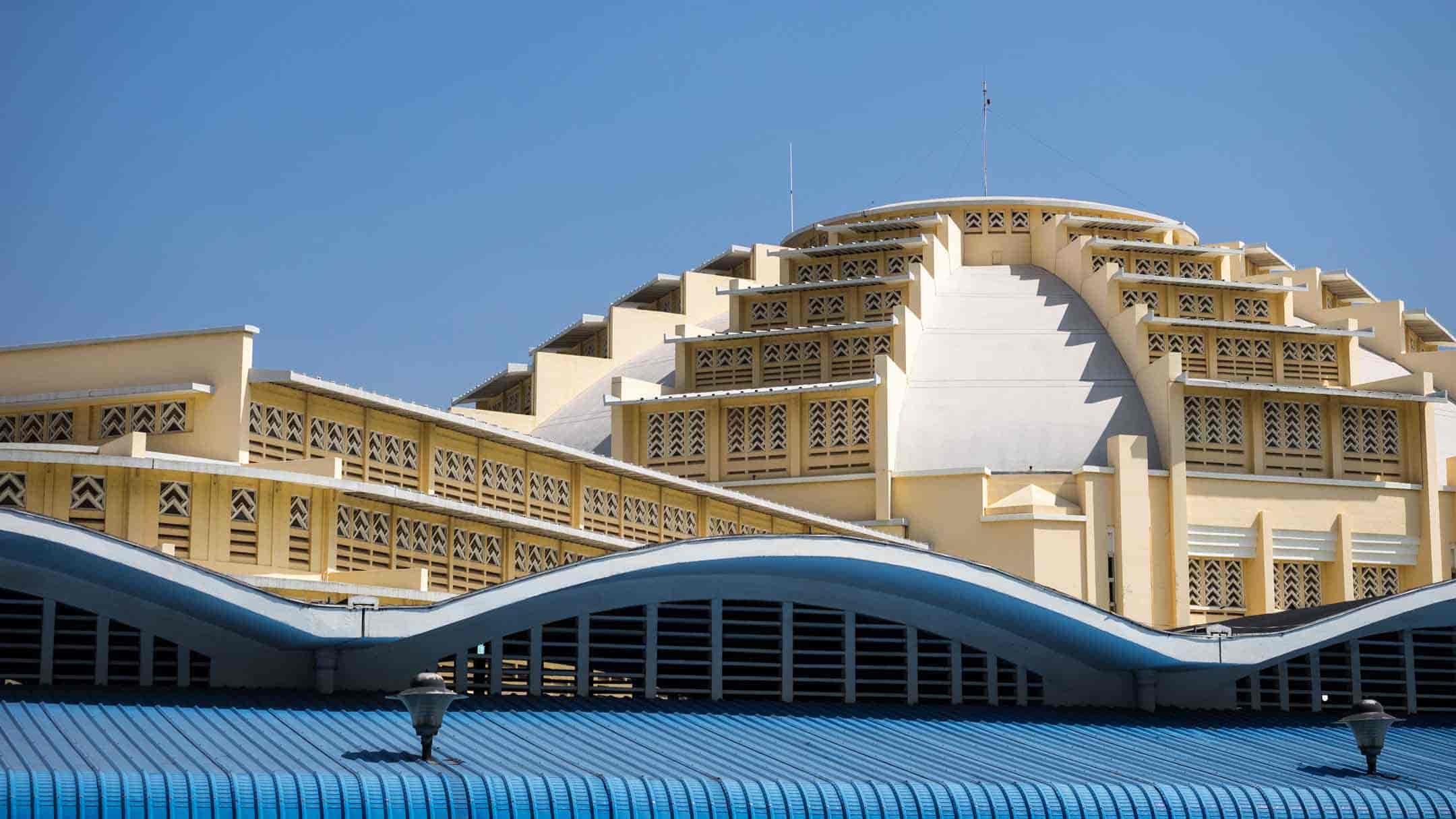
There are many places to stay and eat in Siem Reap – for details and reviews check the many websites, blogs, forums, and guidebooks. Be aware that many of the reviews date from before the pandemic and may not apply now. If the most recent review is dated 2019, the business may not even exist now. During the pandemic, many guesthouses, hotels, bars, cafes, and restaurants closed, as there were hardly any tourists. Many never reopened, some have changed ownership – so pre-pandemic reviews may be useless.
The guesthouse I stayed in before the pandemic closed, and is now a motorbike hire shop. The Blue Pumpkin Bakery and restaurant near the I Viva Mexican restaurant closed, and is now an Indian restaurant. So, there have been quite a few changes in Siem Reap as a result of the pandemic. On a positive note, though, the town’s authorities took advantage of the lack of tourists during the pandemic to upgrade infrastructure, so improved roads, paving, drainage, etc.
Small Tour Circuit
The Small Tour Circuit takes in Angkor Wat, then heads a kilometre north to enter the city of Angkor Thom via the South Gate to visit the Bayon, and the Royal Terraces (Elephant and Leper King), and maybe the Baphuon, then exit via the eastern Victory Gate, maybe take in Thommanon, Chau Say Tevoda, and Ta Keo, definitely Ta Prohm, and maybe Banteay Kdei and Srah Srang.
You can of course do this route in reverse order by visiting Srah Srang for the sunrise, and then heading across the road (literally) to Banteay Kdei, where you may be the only visitor and have the temple to yourself. Or, after Srah Srang, go to the nearby Ta Prohm temple, and again, be one of the first ones there – two hours later (after hotel breakfast) there will be coachloads of visitors!
If are you limited to a one-day visit the Small Tour Circuit will enable you to see the major temples, and a few smaller ones, but it will be a rush. You will also not necessarily be at a particular temple at the best time of day for photography. You will be there at the same time as a lot of other tourists.
You will probably be templed-out at the end of the day, especially if you started early to see the sunrise over Angkor Wat, and then stay for the sunset from Phnom Bakheng. From starting at your hotel in Siem Reap to finally getting back there in the evening is a long day – a 14-hour day! I have done it a few times – it was exhausting every time.
Grand Tour Circuit
The Grand Tour Circuit is even more ambitious, and slightly more expensive, due to the extra distance involved. This route assumes you have already done the small circuit so avoids stopping at Angkor Wat, and passes through Angkor Thom via the South and North Gates, then on to the first stop at Preah Khan temple, maybe Krol Ko and Neak Pean, then Ta Som, East Mebon and Pre Rup, and maybe Ta Prohm, Banteay Kdei, and Srah Srang on the way back to Siem Reap.
Another exhausting day, for sure! Not much time at each temple, and again, you will be there at the same time as a lot of other tourists. It’s even more exhausting if you take in the sunrise and sunset.
My advice would be to spend more than one day visiting the temples and be selective about what you see – you don’t have to see everything in one day. Make your own circuit and choose temples and times to get the best photographic conditions, and fewer tourists. That takes a bit of research and planning, and my various posts may be able to help you there. Be sure to agree the route, timing, and price with your driver before you start, and expect any deviations from the agreed route to cost extra.
Opening hours for the Angkor temples
These are the current opening hours for the temples, taken from the Angkor Enterprises website:
- The ticket office at the entry to the Angkor park is open from 5:00am to 5:30pm. Entry tickets purchased after 4:45pm are valid starting the next day, but also allow you to see the sunset that day and not count as one of your uses. You have to drive through the checkpoint at the ticket office on all trips to the temples to have your Visitor’s Pass checked and clipped.
- The Angkor temples generally are open from 7:30am to 5:30pm. An early start at 7:30am at the popular temples like the Bayon and Ta Prohm means there will be very few people there – many tourists will still be eating breakfast at their hotels.
- Angkor Wat and Srah Srang lake both open at 5:00am for the sunrise, and close at 5:30pm. As it will be totally dark at that time (no lighting) it pays to scout out the location beforehand, in daylight, so you know where to be for the best shots. Wear a headtorch, and get there as early as you can to get the spot you want – lots of people want to be in a similar, or the same, location! Note also that the 3rd level of Angkor Wat (the Bakan) does not open until 6:40am, and closes at 5:00pm. Note also that the Bakan is subject to strict visitor limits – no more than 100 visitors are allowed at any time, with a maximum visit time of 15 minutes (updated 14 Jan 2026). Gone are the days of spending an hour or two photographing the many devatas, so my advice would be to concentrate on the pairs of devatas guarding the four doorways of the central sanctuary, which are probably the finest carvings anywhere at the Angkor temples.
- Phnom Bakheng and Pre Rup both open at 5:00am and close at 7:00pm. After the sunset it will be totally dark (no lighting) so pack a headtorch to navigate down the hill at Phnom Bakheng, or down steep steps at Pre Rup. Note that Phnom Bakheng has a 300-person limit at all times of the day.
- Check the calendar for Buddhist holy days, when the 3rd level of Angkor Wat (the Bakan) will be closed for Buddhist ceremonies. These holy days often occur around Buddhist festivals, such as the Water Festival in November each year, and on full moon days. If your visit is short, and you particularly want to access the 3rd level of Angkor Wat, check the Buddhist calendar before you book anything! Due to the heavy flow of tourists every day, the Bakan is also closed every Sunday for cleaning and maintenance (updated 14 Jan 2026).

©2025 Rick Piper Photography. View a hi-res version of this image, and more, at rpphotoz.com
Sun exposure
Cambodia has a tropical monsoon climate, so it’s hot all year round, and wet more than it is dry. The “cooler” dry season is from November to February, and is the most popular time for tourists to visit, so if you visit at that time, expect crowds.
If you are not used to high temperatures be careful not to get heat stressed, which can lead to heat exhaustion and heat stroke. Take it easy, and stay hydrated.
There’s not a lot of shade at the temples so you will be exposed to the sun a lot of the time. Wear clothes that cover you to avoid burning, sunscreen, and a hat – observe the locals who work outside around the temples, fully covered from head to toe, including gloves! Some visitors carry umbrellas.
Covering up is required at the temples to a certain extent to be respectful – you are visiting religious buildings still in use, not the beach – and the temple guardians who check your tickets at the entry points won’t let you in if you are showing too much skin. This is variably enforced at different temples, but access to the 3rd level of Angkor Wat has strict dress standards – you even have to remove your hat before climbing the steps.
Of course, wearing a hat with a big enough brim to protect your face is a problem for photographers – landscape aspect shots are fine, but portrait aspect shots are impossible. Some photographers wear a baseball cap on backwards, but this does not protect the face or ears.
My solution is to wear a small-brimmed bucket-style hat – to protect the top of my head, ears and forehead – so I can easily shoot in landscape or portrait – and either a shemagh or a traditional Khmer krama scarf around my neck. Either type of scarf is very versatile, and can be wrapped around to cover the whole head/face if necessary – useful on the drive back to Siem Reap with all the exhaust fumes and dirt, especially if you do not have a mask. The scarf is also useful for mopping up sweat, like a towel, although I have seen photographers with hand-towels for that purpose.
You also need to be reasonably fit. You will be climbing up and down steps everywhere. For example, to get from ground level to the central sanctuary on the third level of Angkor Wat you need to climb up a total of 150 steps, and then climb down again.
Accessibility
Sad to say, but none of the Angkor temples are wheelchair-friendly. None! There are no ramps or lifts for wheelchair access (baby strollers have the same problem). So there are some things to consider if you are mobility-challenged.
There are many steps, everywhere. Even to pass through a doorway you will have to climb two or three steps up to the threshold, and then descend again on the other side. At Angkor Wat there is a long wooden stair from the cruciform galleries to the second level, and then a steep wooden stair up to the third level (this stair follows the angle of the original stone steps over which it is built – about 70 degrees – but with handrails). These stairs are wide enough for people to comfortably pass you, so take your time.

©2025 Rick Piper Photography. View a hi-res version of this image, and more, at rpphotz.com

©2025 Rick Piper Photography. View a hi-res version of this image, and more, at rpphotz.com

©2025 Rick Piper Photography. View a hi-res version of this image, and more, at rpphotz.com
In places, there are fallen stones to negotiate, uneven pathways, boardwalks, and dirt paths from the outer enclosure entry gates to the temple proper. If you are ambulant disabled it is doable, with care, but it pays to know your limits. Visit with a partner or friend if possible, even consider paying a local to accompany and assist you.

©2025 Rick Piper Photography. View a hi-res version of this image, and more, at rpphotoz.com
If you are wheelchair-bound it will be hard, and in many cases, impossible to explore inside the temples. If you have some helpers to manhandle you, plus a wheelchair, over a few obstacles, you could see the extensive bas-reliefs at the Bayon, but get there early to avoid the crowds.

©2025 Rick Piper Photography. View a hi-res version of this image, and more, at rpphotoz.com
If you are able to walk a few metres, but then need to sit down to rest, it may be worth bringing along a collapsible wheelchair, or a walking frame that incorporates a seat – both of which could be carried for you by a partner or friend, or even by a local if you are prepared to pay them.
At Angkor Wat the newly restored stone causeway over the moat is doable in a wheelchair, and you could probably return the same way, even though you are supposed to return over what was a temporary floating plastic pontoon installed whilst the stone causeway was being restored – which moves like a giant waterbed – and has steeply sloping access at each end on to the flat section on the water.
Even the ambulant disabled could probably return via the newly restored causeway, especially if you obviously have difficulty walking. The image below was taken before the causeway restoration. The newly restored causeway looks similar to the right-hand side shown below.

©2025 Rick Piper Photography. View a hi-res version of this image, and more, at rpphotz.com

©2025 Rick Piper Photography. View a hi-res version of this image, and more, at rpphotz.com
The real challenge once you cross the moat is climbing the steps up to the three gopuras in the centre of the western gate (no ramp) and down again to ground level, or to the elevated stone causeway that leads to the temple proper. This stone causeway is uneven, about 400 metres long, with no shade. Then you get to the temple proper and many more steps up from ground level to Level 1 to view the extensive bas-relief carvings in the galleries.


However, even if you only make it through the Western Gate, Angkor Wat is awesome! I have been to Angkor Wat many times and I never cease to be awed by the sheer scale of the building. The approach along the stone causeway is magnificent, so take your time and soak up the awesomeness!
There is another option, though. After crossing the moat, instead of trying to tackle the steps up to the central three gopuras of the Western Gate, walk to the far northern or southern pavilions at the ends of the gate. The entries at these locations are nominally at ground level, originally to facilitate the entry of carts and elephants into the temple grounds, although they now have three steps up and down as you pass through!
More walking, but fewer steps to climb up and down, so doable if you are ambulant disabled, but problematic in a wheelchair without some assistance. Once through the pavilions you have a good view of the five central towers of the 3rd level. You then have the option of climbing a few steps onto the elevated stone causeway and approaching the temple proper.
You can also stay at ground level and do a complete circuit around the outside of the temple, exiting via the pavilion at the opposite end of the Western Gate to the one in which you entered. The views of the temple are excellent, but it is a long walk in full sun.


©2025 Rick Piper Photography. View a hi-res version of this image, and more, at rpphotz.com
Not all the temples are mountains of stone with many steps, though. Banteay Srei is at road level, as are the temples of Thommanon and Chau Say Tevoda – literally on opposite sides of the road after you exit Angkor Thom via the eastern Victory Gate, on the way to Ta Prohm. These two temples rarely have many visitors and yet they have some beautiful devata carvings, and are easily accessible.
Even if you can only view the temples from a compacted dirt path they are still awe inspiring, and well worth the effort. Angkor Wat is truly amazing, even when viewed from afar!
If you are interested in some very detailed information regarding accessibility at Angkor Wat, read this survey, published in 2021 at ResearchGate. The survey was undertaken between 2015 and 2019 by the Apsara Authority and two Japanese universities, Komatsu University and Kanazawa University. Nothing much has changed since the survey, but it does highlight the accessibility problems you will encounter if you decide to visit.
If you are accessibility-challenged in any way, and have managed to see some of the temples, please leave a comment below and I will update this post. I am sure there will be many other people interested in your experiences – particularly which temples you visited, and how you managed. In fact, if I receive enough feedback I may make this section on accessibility into a separate post.
Toilets
To the bathroom-challenged, there may be a few problems – not so much concerning availability, because there are plenty of toilet facilities at the temples, but they are not everywhere, and you may not be near one when you need it. Your tuk-tuk or taxi driver will know where the nearest toilets are.
I recommend you use the facilities at the main temples when you have the opportunity, as there may be none, or very basic facilities at the smaller sites. As Jack Nicholson’s character in the movie The Bucket List says, one of the things to remember when you get older, “never pass up a bathroom”.
This is a list of toilets at the main Angkor temples, mostly western-style, and free to use with a valid Visitor’s Pass:
- Angkor Wat has excellent quality facilities near the main shopping/eating complex close to the entry point, wheelchair accessible.
- Ta Prohm has good facilities, but with limited accessibility.
- Banteay Srei has basic facilities with minimal accessibility.
- Bayon has good facilities, but with basic accessibility.
- Beng Mealea has clean facilities near the ticket office/entrance.
- Ta Prohm has good facilities, but with limited accessibility.
There are some facilities at other temples and your driver will know where they are, but they may be squat toilets, and be very basic. It is always a good idea to carry toilet paper and wet wipes with you. If you have continence problems, maybe wear continence pants, but you already knew that.
If you find some toilet facilities at the other temples, good or bad, please leave a comment and I will update the list above.
Water and food
Take plenty of drinking water. You will probably sweat a lot, so don’t risk dehydration. Although you can buy water and other drinks at many places in Angkor, it’s expensive, so if you are on a tight budget, take it with you.
Food is available at many places, too. From small food stalls amongst the souvenir stalls, to cafés and restaurants, such as the sit-down Angkor Wat Café opposite the main entry to Angkor Wat (which used to be the Blue Pumpkin Café), there is a good choice. I’ve never had a bad meal at the temples, and never been sick from eating there.
Note that the Angkor Archaeological Park has been smoke-free since 2012, except in designated areas – where these are I have no idea, not being a smoker, but if you know of any, please leave a comment and I will update this post.
Landmines
I know this section may sound melodramatic to some, but no advice for visitors to the Angkor temples would be complete without mentioning landmines. This is not meant to put you off, just to make you aware of the problem that Cambodia continues to deal with, decades after the civil war ended.
As a result of the long civil war in Cambodia, the country has been left to deal with millions of unexploded landmines and other ordnance. This has affected the whole country, particularly rural areas, and especially in the northwest of the country, near the border with Thailand, where the Khmer Rouge retreated to, and made their final (unsuccessful) stand against Thai and Vietnamese military forces. Since the final defeat of the Khmer Rouge in the late 1990s, unexploded ordnance has caused the deaths of over 60,000 people.
Beginning in the early 1990s, a concerted effort was made to clear the land, resulting in the removal of about four million munitions – that still leaves an estimated six million munitions undetected. Landmine clearance is ongoing, and about 1,000 sq. kms (386 sq. mi.) still need to be cleared. Unexploded ordnance not only affects tourism, but agriculture in particular, with much productive land wasted until it has been cleared.
So how does this affect your visit to the Angkor temples?
Thankfully, not much really, so do not let this dissuade you from visiting – but note that a lot depends on where you go. As tourism is a major contributor to the Cambodian economy, the areas around the Angkor temples have been cleared. It is only when you visit the more remote outlying temples – such as Banteay Chhmar (double “h”, not a typo!), Beng Mealea, Preah Vihear, the Kulen Hills, etc – that some caution is needed.
In those locations, all the temples and pathways will have been cleared, but I would not recommend wandering off the track into the jungle. I keep to the well-worn paths made by the locals. Am I being overcautious? Maybe, but we all have different risk profiles, and I do not want to end up as a statistic. Better safe than dead!
Ticket Pricing
Ticket prices, payable in US$ at the official ticket centre, or by credit card online, are, at the time of writing (2025):
1 Day – US$37
3 Day – US$62 (valid for ten days)
7 Day – US$72 (valid for one month)
Online tickets sales are here, click on the green “Buy Tickets” button:
https://angkorenterprise.gov.kh
The tickets have been these prices for 8 years now, since 2017. At that time, many tourism operators thought the price increase, from US$20/$40/$62 respectively, would be detrimental to visitor numbers. This has not been borne out by visitor number statistics, the COVID pandemic period notwithstanding.
The 7-Day ticket for US$72 is an absolute bargain, even if you only use it for four days. Where else in the world can you visit an historical site of this magnitude for only US$10.30 a day?
You will be issued with a laminated Visitor’s Pass with your photo on it (taken when you buy the ticket), which you have to show at every temple to gain entry.
The Visitor’s Pass allows you visit all the temples in the Angkor Archaeological Park near Siem Reap, and also includes access to the more distant temples of Banteay Srei, Bakong, Preah Koh, the Roluos Group, and Beng Mealea (which used to be an additional charge, on top of the Angkor visitor’s pass, but not any more).
Additional charges of US$10 are made on-site for access to the more far away temples of Beng Mealea (but only if you do not have a valid Angkor visitor’s pass), Koh Ker, Preah Vihear, Sambor Prei Kuk, Banteay Chhmar (double “h”, not a typo!), and Preah Khan of Kompong Svay.
There is also an Angkor Special Pass, a free yearly pass for foreigners and investors who have lived in Cambodia for at least two years. Apply online here, and click the green “Special Pass” button:
https://angkorenterprise.gov.kh
Note that there are some age restrictions to some parts of the temples, which you should take into account when planning where to go if you are visiting the temples with children.
Children under 12 years old are not allowed access to:
- The 3rd level of Angkor Wat, the Bakan (very steep wooden stairs).
- The Phnom Bakheng summit (steep, narrow stone steps).
- The upper levels of Ta Keo (steep, narrow stone steps).
- The stairs up to the higher levels of the Baphuon, (again, steep wooden stairs).
It is recommended that you carry your child’s passport with you at the temples to prove their age – some twelve-year-olds look younger than others.
Those restrictions for children under 12 years old, listed above, also apply to visibly pregnant women and people with heart conditions (updated 14 Jan 2026). The access at those locations is hazardous, especially the steep, and very narrow, stone steps worn smooth by feet and the weather for centuries, so you are being restricted for your own safety.
Other Posts on the Angkor Temples
This post, Part 2, contains practical advice for visiting the temples.
Part 1 is a general introduction to Angkor, mainly a historical overview and some clarification.
Part 3 contains general photographic advice and some useful resources for researching the temples, including a list of other posts in this series that will address individual temples, listed below, with tips for getting the most out of your visit photographically. These blog posts, based on my experiences, may help you get some great images.
If there is a hyperlink in the list below, I have published the post. I hope you will be inspired!
- Angkor Thom – Ancient Khmer City
- Angkor Thom – Elephant Terrace
- Angkor Thom – Royal Palace Compound & Phimeanakas Temple
- Angkor Thom – Suor Prat, the Khleangs, and Preah Pitu
- Angkor Thom – Terrace of the Leper King
- Angkor Wat – Introduction
- Angkor Wat – Sunrise and Sunset
- Angkor Wat – Western Gate
- Angkor Wat – Eastern Gate
- Angkor Wat – Cruciform Galleries
- Angkor Wat – 2nd Level
- Angkor Wat – 3rd Level
- Banteay Kdei
- Banteay Samre
- Banteay Srei
- Baphuon
- Bayon – Face Towers
- Bayon – Bas-reliefs
- Bayon – Devatas and Apsaras
- Face Towers at the Angkor Temples
- Preah Khan – Eastern Entry
- Preah Khan – Hall of Dancers
- Preah Khan – Central Courtyards
- Preah Khan – Western Entry
- Ta Prohm
- Ta Prohm – Tree Roots
- Tree Roots at the Angkor Temples
Camera Gear
All images in this post were shot either:
- Using Fuji Sensia transparency film in Olympus OM1 cameras, with Zuiko lenses – transparencies were then scanned using a Nikon ED5000 film scanner and processed in Photoshop
- Or, shot in RAW using digital Nikon camera bodies, with Nikkor Pro f2.8 lenses, and then processed in Lightroom and Photoshop.
- Or, shot in RAW using digital Olympus OMD camera bodies, with Zuiko PRO f2.8 lenses, and then processed in Lightroom and Photoshop.
All images Copyright ©2025 Rick Piper Photography (unless noted otherwise). All rights reserved.